

Technical details
- Location : Bhagsu, Dharamshala, Himachal Pradesh, India
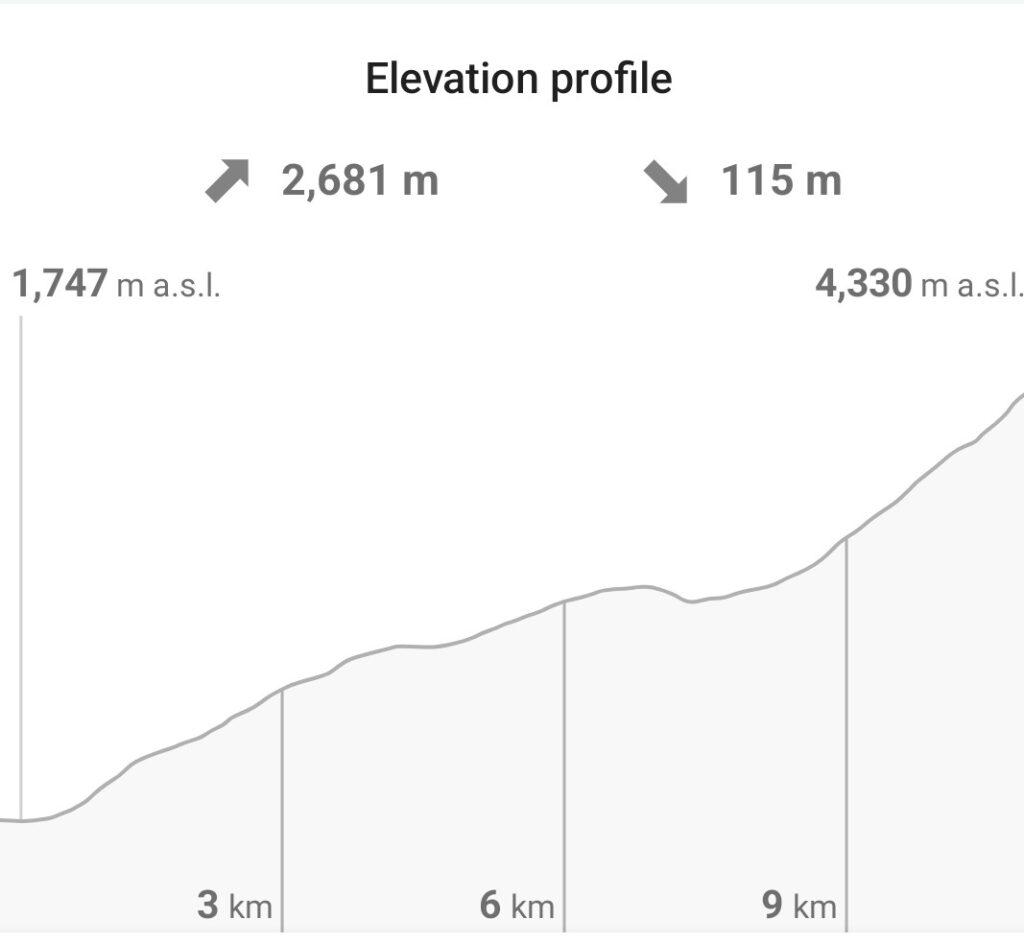
- Elevation gain : 2681 m
- Altitude : 4342 m
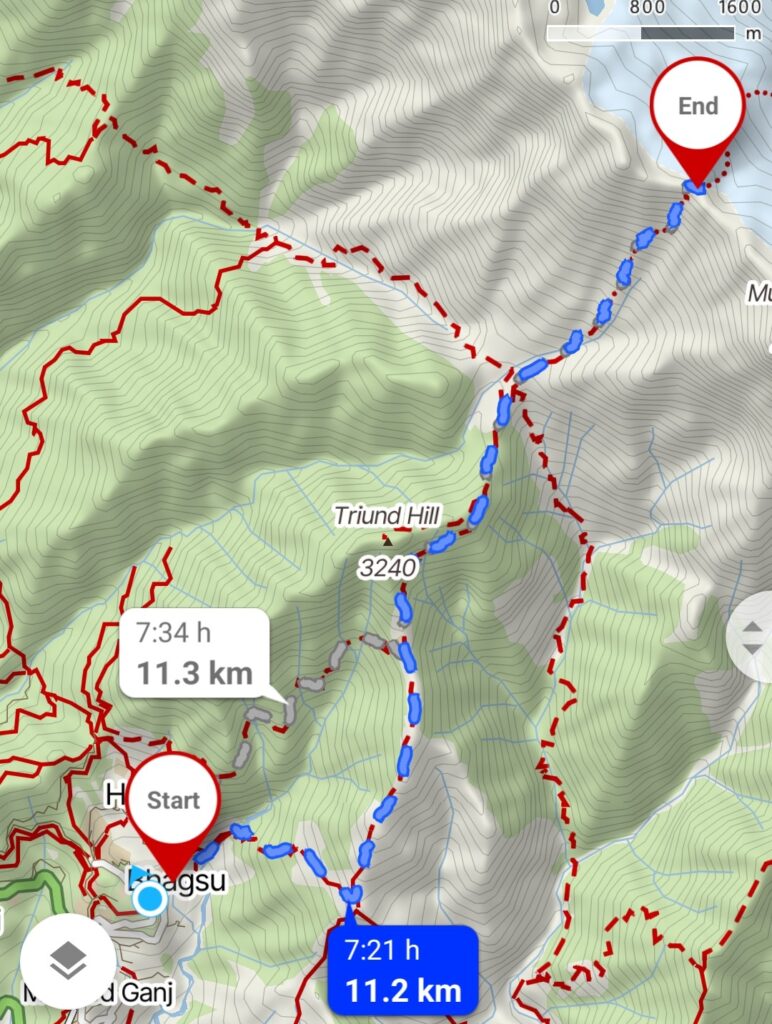
- Length : 11.2 km
- Time to complete : 2-3 days
- Difficulty : challenging
- Best period : mid September – mid October
Trek description
The Indrahar Pass trek can be completed in 2 days, but if you can make room for 3 days, that might be more comfortable for your leg joints…

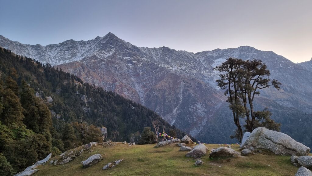
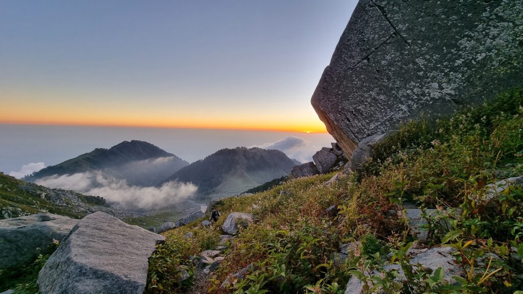
Starting from Bhagsu waterfall, you should first reach the Shiva café and cross the river. After about 3 hours climbing up, you reach Triund, where you can buy some food and rent tents and sleeping bags if you want to spend the night. The sunrise from Triund is quite spectacular.
Most day hikers stay overnight in Triund. After that point, you will meet fewer people on the way. The next café / camping place is Snowline, which you can reach in 1 hour from Triund. Then you arrive in Dhauladhar café, which is the last place where you can buy food, water, or rent tents for the night.
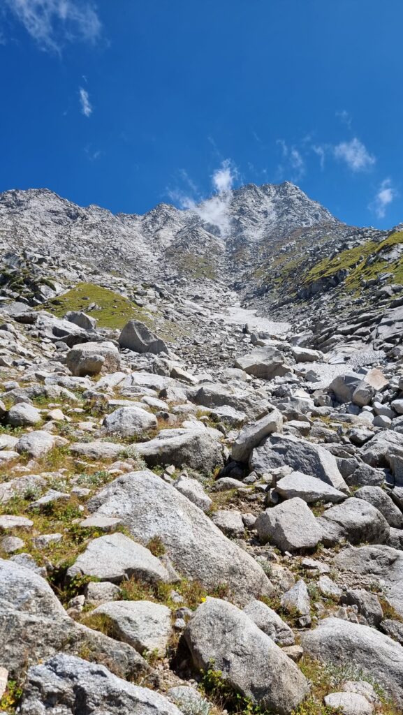
After Dhauladhar, it’s getting more serious. You follow a track that gets steeper and steeper. You’ll sometimes need to scramble and use your hands, but you won’t face anything overly technical, though. The path is made of flat rocks placed over the years by the local shepherds. The rocks act like stairs, which make progress much easier. However, it’s easy to lose them as they dissappear among the other rocks. Just follow the cairns, and you’ll be fine. Your offline map will be useful to avoid getting lost.
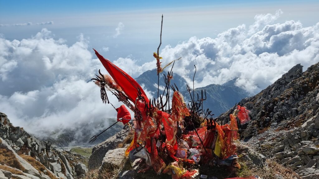
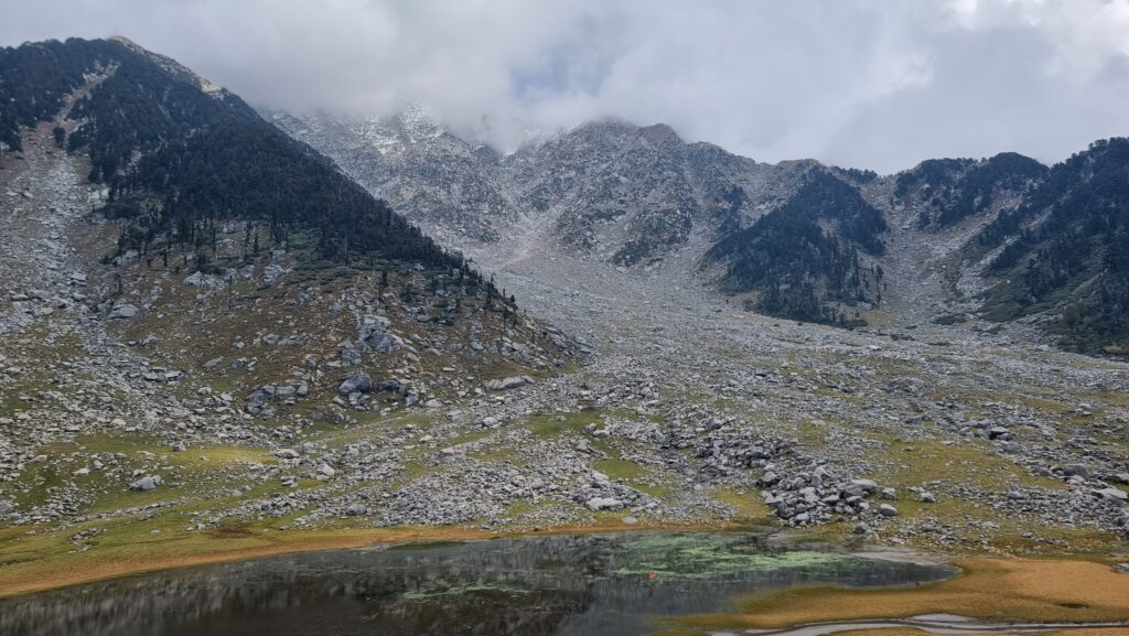
Around midpoint, you reach Lahesh cave where you can sleep on flat ground if you carry your camping gear with you. After 3-4 hours of steep climb, you reach Indrahar pass, at 4342 m above sea level. A huge India flag is proudly painted on the rock. Congratulations, you made it !
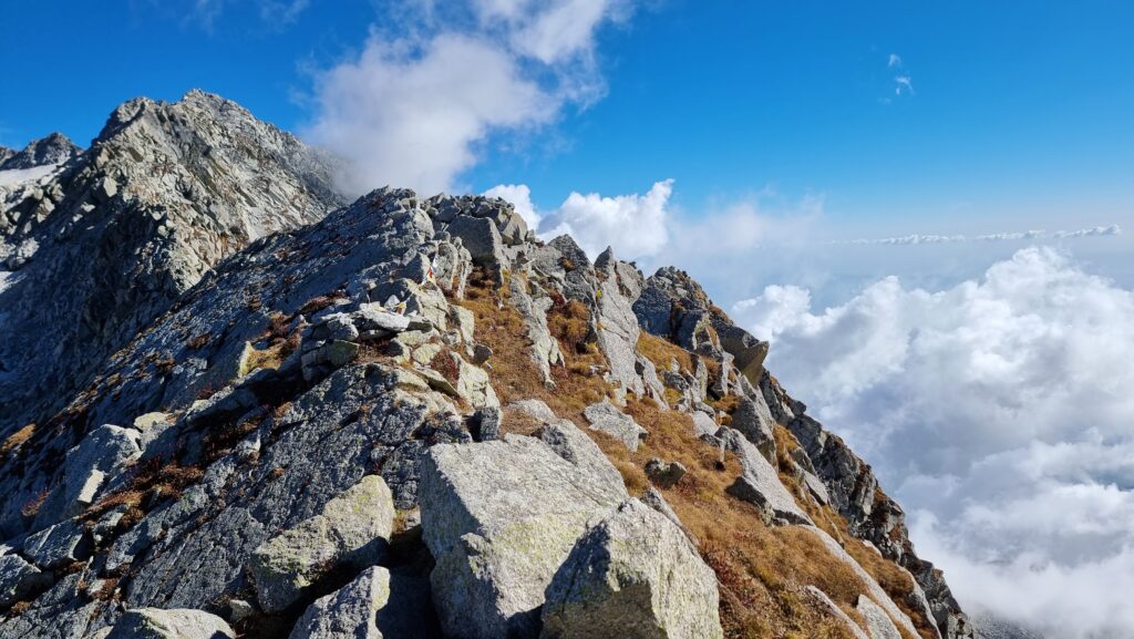

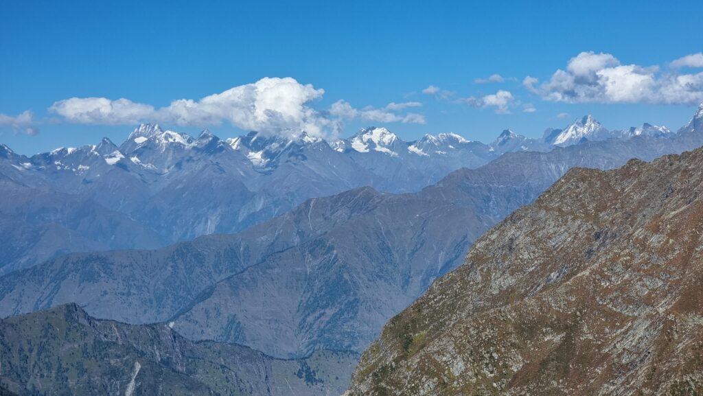
From the pass, you can see Mun peak on the right and snow-caped mountains in the far back. If you have enough time, you can reach Nag Dal Lake on the left. However, you’ll have to make your own way as there’s no official track, just some cairns here and there indicating the direction. If you’re considering this section, having a local guide with you could be useful.
This trek is not particularly long, only 11.2 km. However, its large elevation gain – 2700 m makes it quite challenging, and if you’re not used to altitude, you might get a little headache and get short of breath.
Congratulations, TO YOU, you should say! you made it!
I liked “just follow de cairn, and it will be fine” 😂. Everything is cairn according de following picture!
Yes indeed I made it and everyone else who did it should be also proud 😉 By cairns, I mean the piles of stones marking the trail. The trail would be much harder to follow without them.