
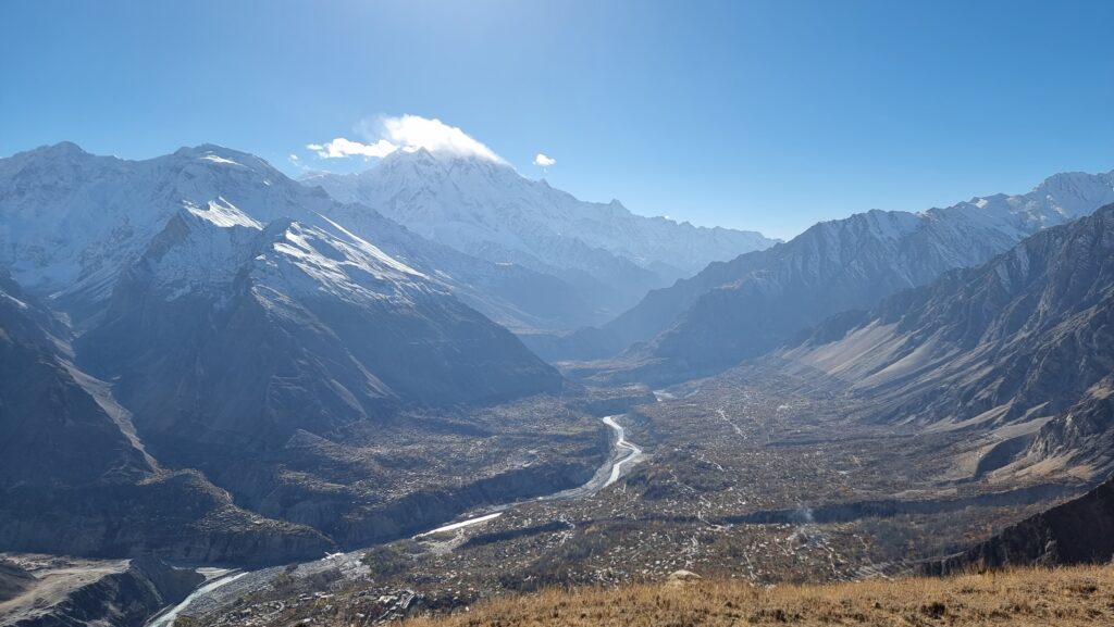
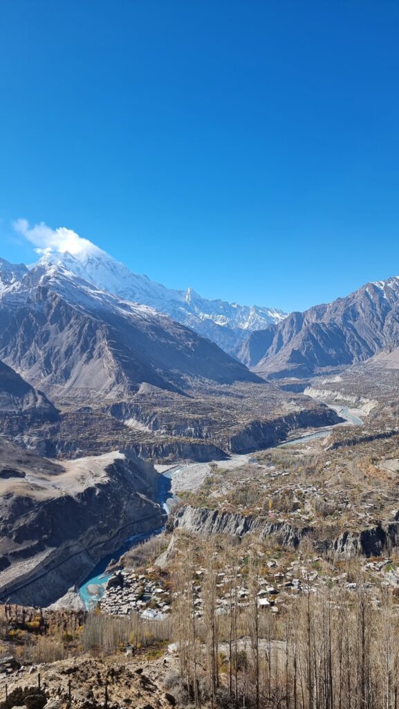
The majestic Hunza valley is a popular destination among travellers, and rightly so. Its unmatched beauty left me struck with awe and I found it really hard to refrain myself from taking pictures the whole day. This natural wonder features the highest concentration of 7000-metres peaks on earth, seven of them can be seen from the valley.
Despite its fame, it’s possible to find off-the-beaten-track hikes in the Hunza valley. The Hosht hike really deserves more recognition, and I’ll do my best to repair this injustice with the present trek report to the Hosht viewpoint.
Technical Details
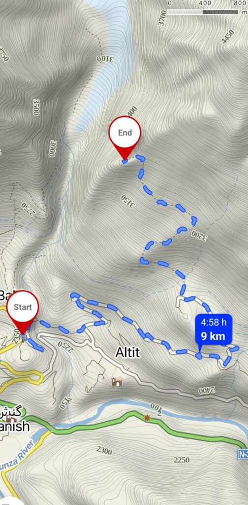
- Location : Duikar village, Hunza Valley, Gilgit-Baltistan, Pakistan
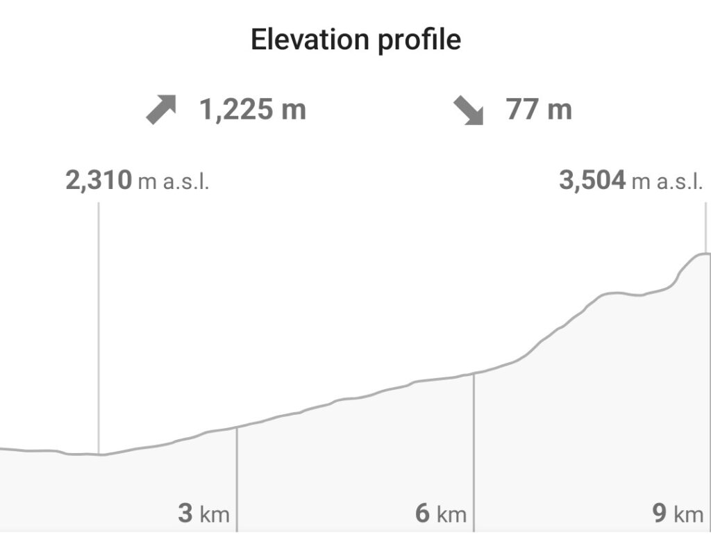
- Elevation gain : 1225 m
- Altitude : 3504 m
- Length : 9 km
- Time to complete : 5-6 hours
- Difficulty : Intermediate
- Best period : April – October
Trek description
This is an intermediate hike that can be completed in one day. You can also make it a much easier hike if you come to the Duikar village by vehicle. If you have time and if you’re in the mood for a more challenging hike, I’d recommend you to start walking from Baltit.
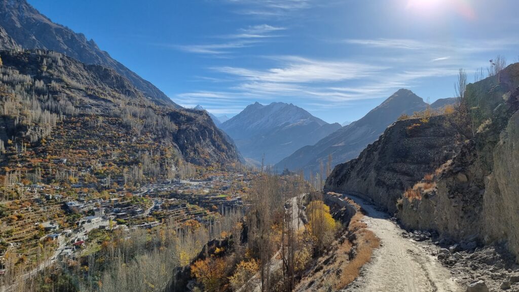
The first part of the hike follows the Agha Khan road, a quiet road that will take you through cute villages. I was lucky to be there in Autumn, when the tree leaves turn yellow, orange or red, contrasting beautifully with the white of the snow-capped peaks.
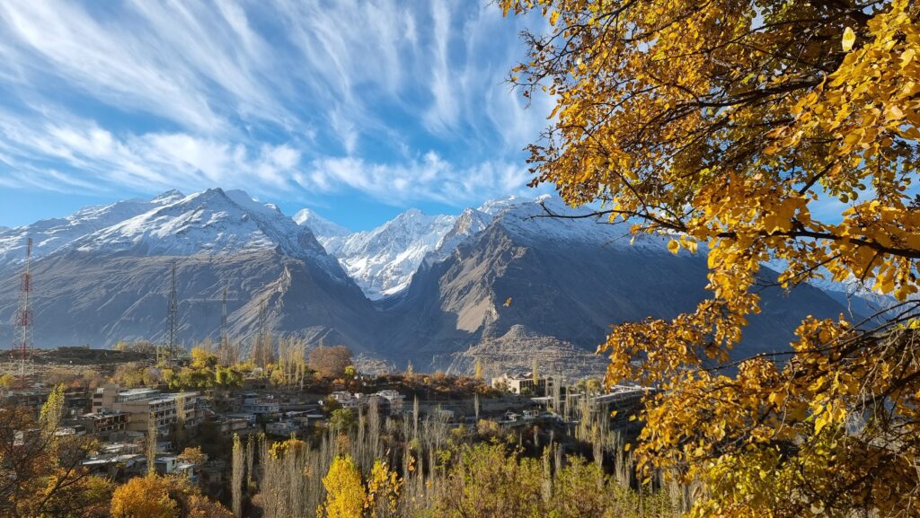
Soon enough, you’ll reach the touristic Duikar village where you can find some corner shops and some local food. You can (and should) visit the Eagle’s nest view point, from where you’ll receive an impressive vantage point on the whole valley.
After some rest, the hike continues on a dusty and rocky trail. The entrance is in front of the Hard Rock hotel. It’s possible to do this hike without a guide, but I’d highly recommend having an offline map on your phone to avoid getting lost. I personally use Mapy.cz, where the Hosht viewpoint is listed as “Hunza / Ultar / LadyFinger view”.
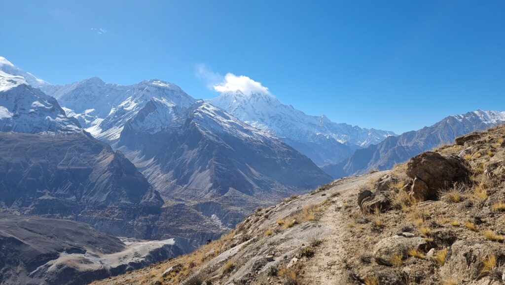
The trail brings you to a first flat top where the views are already incredible. Keep going up and after passing some stone-built shepherd’s house, you will reach a big boulder. Turn left after the boulder and follow the contour line on the side of the slope. The trail sometimes disappears, but if you follow your offline map, you should be fine.
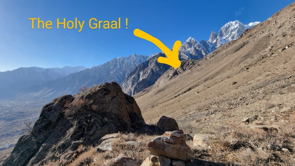
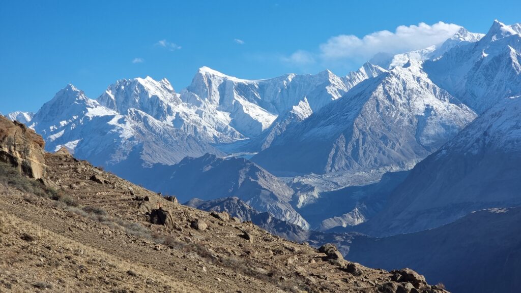
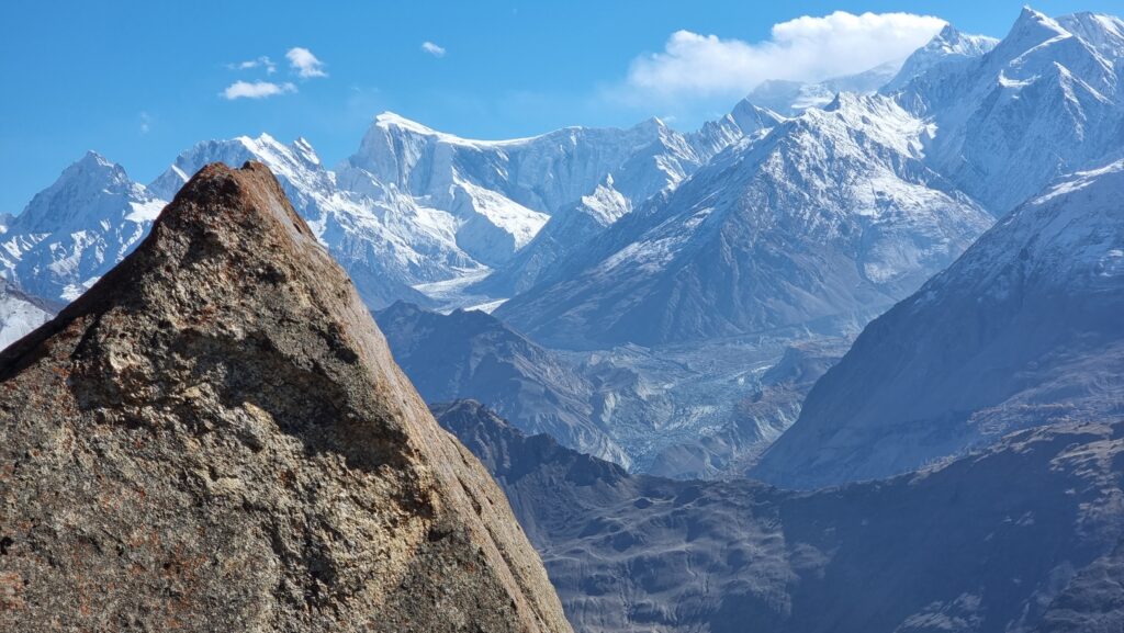
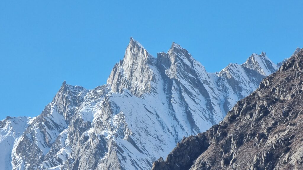
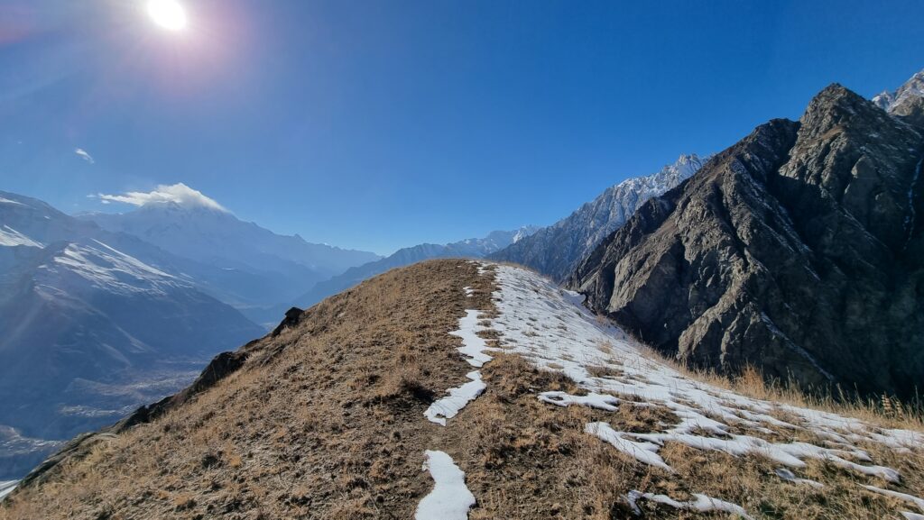
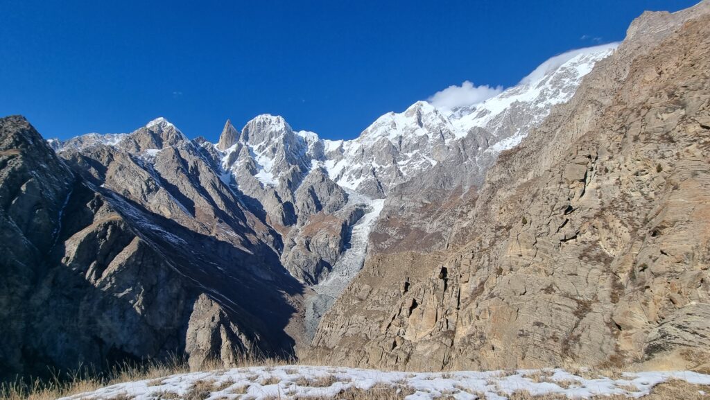
The last section is the steepest but after a last effort, you’ll be rewarded by some out-of-this-world views. To the South, the Hunza river is dominated by some incredibly high peaks, including the mighty Rakaposhi. To the North, the Ultar glacier makes its way down the slopes of the Hunza peak and the LadyFinger, which are part of the Batura Muztagh mountain range. I even witnessed a massive avalanche while I was there!
I didn’t meet a single soul on the Duikar to Hosht section, which was great but I also think this spectacular hike deserves to be better-known. If you’re looking for a great day-hike in the area, definitely check this one out!
Pierre! I see you are doing great, you are a brilliant writer, travel enthusiast and inspiration.
Than you for sharing!
Thanks for your kind words and support Shoukat 🙂 you live in a stunning region
Awesome post! I like the pictures 🙂
Thanks mysterious visitor 😉
i loved your pictures and videos about hosht hike, hunza valley. loved your blog.
Thank you Jiya for your kind words 😀